Requirements: Android 2.2+
Overview:
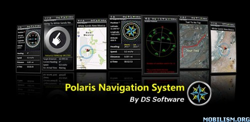
Polaris Navigation System is a complete navigation package for road and off-road navigation

This app has a banner ad with an option to remove ads
More Info:
The Polaris Navigation System package includes:
Reporting on all standard GPS parameters
-Latitude and Longitude
-Altitude
-Speed
Heading (includes magnetic declination correction when in magnet mode)
Odometer
Time en route
Directional compasses (customizable)
Waypoint Management System
-Set waypoints from map, enter coordinates or save current position
-Editable Waypoint Database for storing waypoints
-Waypoint-Finding Compass - A dynamic waypoint-finding tool that always points to your waypoint- just follow the arrow and you'll wind up at your destination!
Maps (street and satellite maps) for setting and viewing waypoints, trails and your position
Trail Management System
Trail Recorder
Editable Trail Database for storing and retrieving trails
Overlay your trail on street or satellite maps
Waypoint Guidance System
-Includes the waypoint-finding compass and reports target coordinates, heading, speed,
Email a map of your position
Get turn-by-turn driving directions from your position or from a specified address or coordinate
Data protection system- your data is backed up regularly meaning you will not lose your progress if you need to change batteries while en-route


